Main Kingdoms of Meenas
*note-some names of person and palace may be not exact , because this history s destroyed by Ancient ,Medivel,Moden socity
| S.No | Name of the Kingdom | Clan and name of the Meena Rulers |
| 1. | Khoh-Gong | Chanda Agnivanshi (a branch of Chauhan) see Dhundhar, Rāja Alansingh Meena |
| 2. | Maach | Sira, Rājah RaoNattō Singh Meena |
| 3. | Gatoor & Jhotwada | Nandla (also called Bad-Goti) |
| 4. | Amer (old city of Jaipur State) | Soosawut/Susawat, Rājah Bhanu Singh Meena |
| 5. | Nayala | jhirwal |
| 6. | Naen\Nahn | Gomladu, Raja Bada Singh Meena or Prince Bada of Nahn |
| 7. | Ranthambore | Taatu(a branch of Chauhan), Rāja Jauharsingh Meena |
| 8. | Bundi | Ushara (Parihar Meenas or Pratihar), Rāja Jaita Singh Meena ,badla meena |
| 9. | Mawar | Meena |
| 10. | Baiplawat | Nandla / Badgoti , Ajmer |
| 11 | Devbandah | Dagal, Rājah Katarao Meena |
| 12 | Tehla (near Sariska Tiger Reserve) | Bheemroth |
| 13 | Siroh | Jakhiwal |
| 14 | Manota | Devadwal / Davidwal |
| 15 | Boojh | Saugun / Saugan |
| 16 | Thanagazi (Alwar District) | Mewaal, Rao Shivasingh Meena |
| 17 | Sarjoli | Mandor |
| 18 | Godwad ( Sirohi State) | Godmina |
| 19 | Nareth | Byadwal Meenas Dynasty |
*
The Kachchwaha belonged to the Kshatriya, or the warrior caste of Hindus, but they traced their origins back to the sun, via Kusa who the twin son of the god Rama.
Main Forts build by Meena Kings
1. Amer (old city of Jaipur State) Soosawut/Susawat, Rājah Bhanu Singh Meena
During 11th century Khoh (at present Khoh Nagoriyan near Jaipur) was ruled by Raja Aalan Singh Meena of Chanda Gotra
Meanwhile the kingdom of Gwalior (called Narwar at that time) was being ruled by Sodh Singh who was assassinated by his brother. The queen and her son (Dulha Rai or Dhola Rai, grand father of Bharmal) managed to flee the kingdom and were given refuge by the Aalan Singh who adopted that child as his nephew.
It was her son who used the trust bestowed upon him by the king and conspired with Rajputs and attacked the fort when the Meenas were most vulnerable
(During the Diwali time where they would give up arms for whole day and pay homages to their ancestors by taking dips in Badli's pond)( ancient tradition that is called pitratrapan)
Amber was capital of Meena kings. Its ancient name was Amrapura (आम्रपुर). Founded by the Meena Raja Alan Singh (He was from Chanda clan of Meenas), Amber was a flourishing settlement as far back as 967 AD.
Around 1037 AD, it was conquered by the Kachwaha clan of Rajputs. Much of the present structure known as Amber fort is actually the palace built by the great conqueror Raja Man Singh I who ruled from 1590 - 1614 AD.
Col. G. B. Malleson writes:-The kingdom of Jaipur, better known as the kingdom of Amber or Dhundhar, was founded by Dhola Rae in the year 957. Dhola Rae was thirty-fourth in descent from Raja Nal, traditional founder of the kingdom and city of Narwar.
The exploits of Dhola Rae can only be traced in the fabulous legends of the period. This much is clear that he conquered the country inherited by his descendants. That part of Rajasthan was then divided amongst petty Rajputs and Mina(meena) chiefs, all owing allegiance to the Hindu Kings of Delhi. These he conquered in succession, and marrying the daughter of the Prince of Ajmer, he laid the foundations of a kingdom destined to be permanent.Killed in battle, Dhola Rae was succeeded by his posthumous son by the daughter of the princess of Ajmer, named Kankal ; he, again, by his son Maidul Rao, a warrior and conquerer ; and he, in his turn, by Hundeo. Kuntal followed him, and he it was who completed the subjugation of the other aboriginal race of the Minas.
2.Nayal\Nahn The region was governed by Rao Deva Hada, who took over Bundi from Jaita Meena in 1342
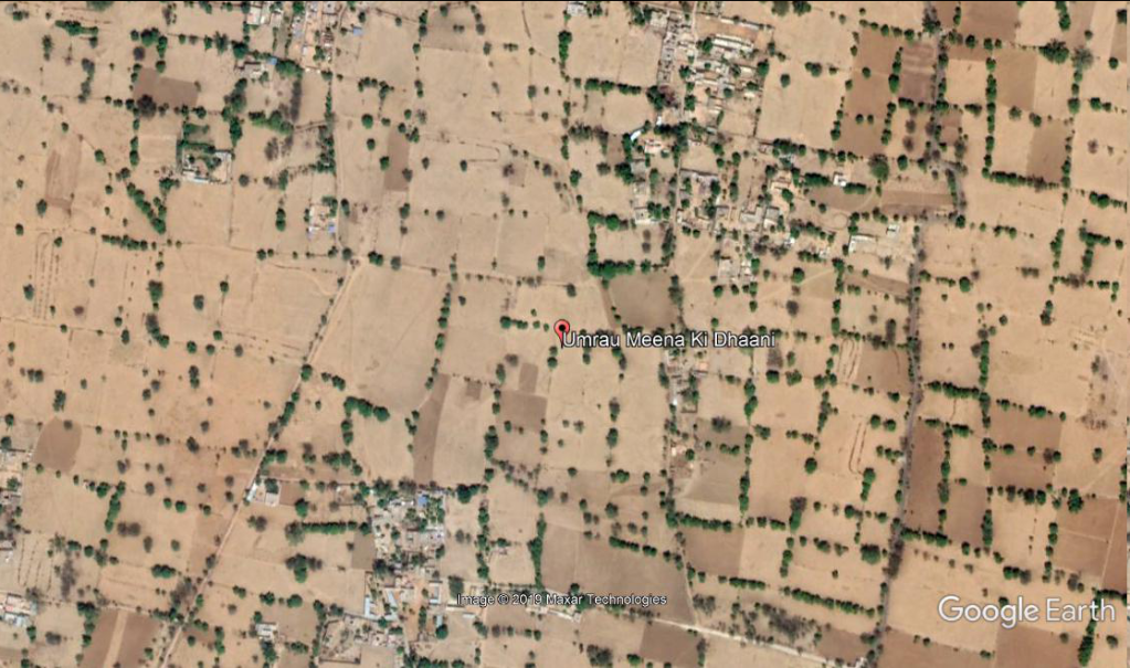
Google Earth Co-ordinates 27°10'08.75" N 76°34'33.29" E
In ancient times, the area around Bundi was apparently inhabited by various local tribes, of which the Parihar Meenas were prominent.Bundi and the eponymous princely state are said to derive their names from a former Meena chief called Raja Bunda Singh Meena. Bundi was previously called “Bunda-Ka-Nal", Nal meaning “narrow ways”. Bundi is situated in a narrow valley within the Aravalli Hills in Rajasthan.
Listen Must This is Real History Not just a Song , i Hate That Type of Songs But seriously this song gives me goosebumps.
Rajasthani Reinvention: Nayal Fort India's Nayal Fort Undergoes a Total Transformation
Banskho (bassi) is nahn ruld by banda/bunda/bada meena , bunda
3.Bundi Ushara (Parihar Meenas or Pratihar), Rāja Jaita Singh Meena ,bada meena

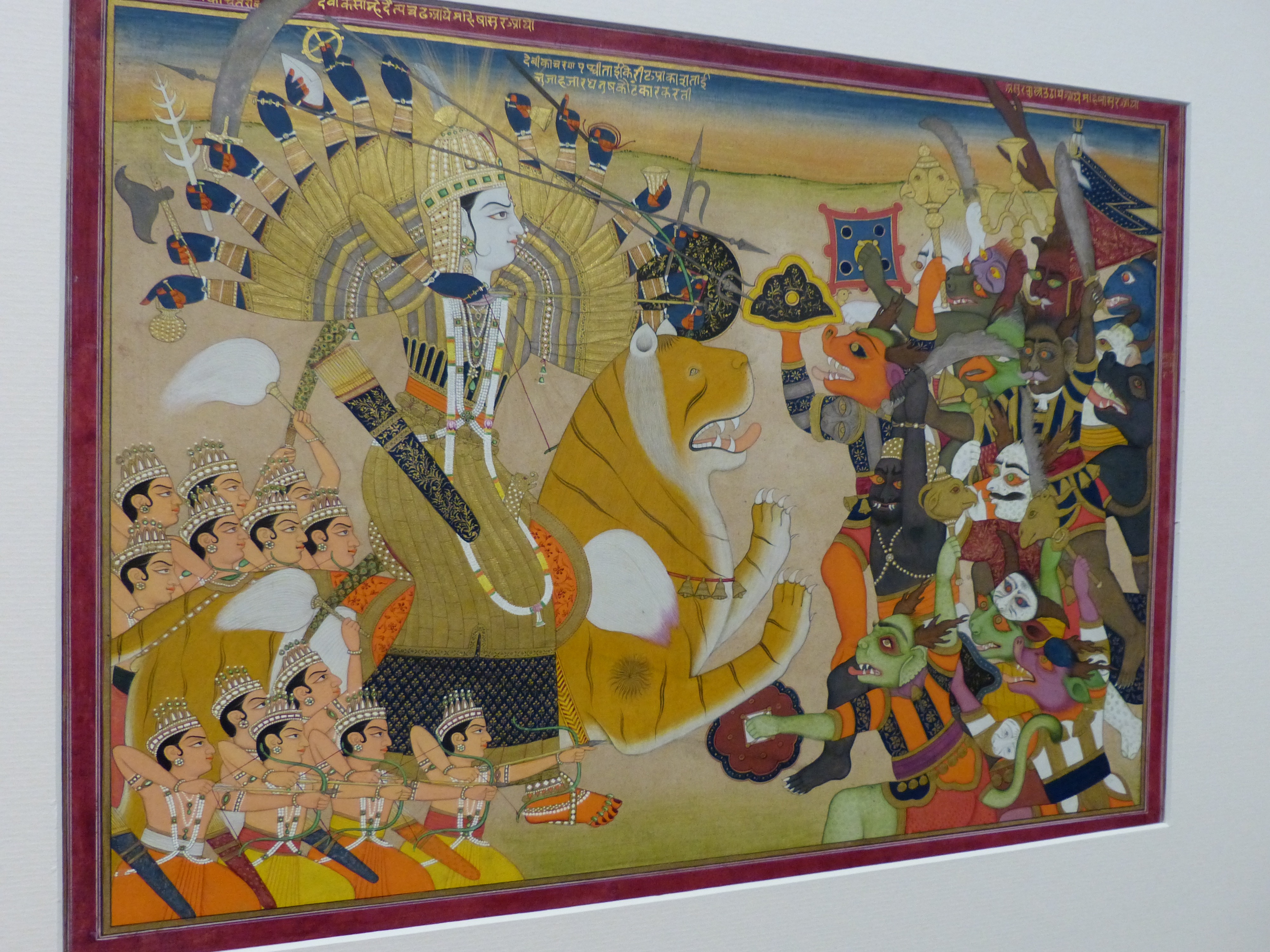
Original Image by -Victoria and Albert Museum, London
Bundi Kingdom of Meena's
James Tod write...Rao Dewa, S. 1398 (AD. 1342), took the Bandu valley from the Meenas, founded the city of Bundi, and styled the country Harawati. James Tod writes that having resigned Bumaoda to Hara-Raj, Rao Dewa came to Bandu-Nal, the spot where his ancestor Colun was cured of disease.
Here the Meenas of the Usarda tribe dwelt, under the patriarchal government of Jaita, their chief there was then no regular city ; the extremities of the valley (thal) were closed with barriers of masonry and gates, and the huts of the Meenas were scattered wherever their fancy led them to build. It was in S. 1398 (A.D. 1342) that Jaita and the Meenas of Usarra clan acknowledged Rae Dewa the Hara Chauhan as their lord, who erected Bundi in the valley of the Bandu-ca-Nal, which henceforth became the capital of the Haras.
The Jait Sagar Lake
For those who want to revive the splendor of the realm of medieval India, they must map out a family trip to southern Rajasthan to travel around Bundi. It is ostentatious about its chocolate box surroundings, antique edifice and museums acting as a storehouse of art and artifacts. Blessed by the bounty of nature, the land is crisscrossed with sparkling rivers, lakes and spellbinding waterfalls. their serene and tranquil ambience are a respite from the din and bustle of city lives.
Bundi bordered by a very big wall has four patterned gateways can be truly called as the throne of Rajasthan. It has been carrying its charm and is really worth of getting endless love and praise from the tourists.
History of Jait Sagar Lake
Very skillfully, Jait Sagar Lake is a gorgeous man made lake nestled among the hills built by Jaita Meena. The lake is surrounded by hills on all sides and has a fountain in the middle which is a visual treat to your eyes. It is a complete delight to see this fountain in the gleaming light of moon. The calm and peaceful atmosphere here is sure to have a very soothing effect on all souls.
.
Description of The Jait Sagar Lake Historically, the idea was brought forward by Jaita Meena to construct this appealing Jait Sagar Lake. It has fleeting cascade looks amazing in the night.
4.Ranthambor Taatu(a branch of Chauhan), Rāja Jauharsingh Meena
Date between 1590 and 1595

Akbar's entry into the fort of Ranthambhor after the submission of the Rajput, Rai Surjan Hada.
Date: between 1590 and 1595
5. Baiplawat: Nandla / Badgoti , Ajmer
Ancient History
In due course of time Dhola subsequently married Maroni the daughter of the prince of Ajmer. Once he was returning along with Maroni after visiting the shrine of Jumrali Mata, the entire force consisting of about 11,000 Meenas of the region assembled to oppose his passagethrough their country. Dhola's force met with Meena force but he was killed and his followers fled along with Maroni, who later gave birth to a child named Kankul. Later he conquered the country of Dhundhar. His son Maidul Rao made a conquest of Amber from the Susawat Meenas. Amber was then the residence of the chief called Bhatto who had the title of Rao and was the head of the Meena confederation. He was also responsible to subdue the Nandla Meenas and added the district of Gatoor-Galti in his territory.On the other hand, Hoondeo succeeded and like his predecessors continued the warfare against the Meenas.
Location
[googlemaps https://www.google.com/maps/embed?pb=!1m18!1m12!1m3!1d12185.60800364279!2d74.69198922400376!3d26.280279984462453!2m3!1f0!2f0!3f0!3m2!1i1024!2i768!4f13.1!3m3!1m2!1s0x3969593720214353%3A0x81f716e2682e9590!2sNandla%2C%20Rajasthan%20305601!5e1!3m2!1sen!2sin!4v1575676852525!5m2!1sen!2sin&w=600&h=450]
6.Devbandah: Dagal, Rājah Katarao Meena
Location
Dagal Rajasthan 327027
[googlemaps https://www.google.com/maps/embed?pb=!1m18!1m12!1m3!1d24860.416029450556!2d74.40928538194302!3d23.84577406070095!2m3!1f0!2f0!3f0!3m2!1i1024!2i768!4f13.1!3m3!1m2!1s0x3966ef6b70420d5b%3A0x2cf41b2023c85579!2sDagal%2C%20Rajasthan%20327027!5e1!3m2!1sen!2sin!4v1575676768955!5m2!1sen!2sin&w=600&h=450]
7. Bheemroth: Tehla (near Sariska Tiger Reserve)
Location Of Tehla and Video Of a Mysterious Ancient Fort Tahla
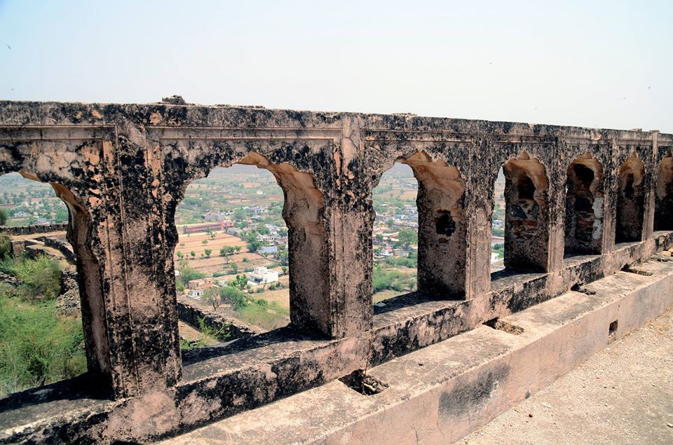
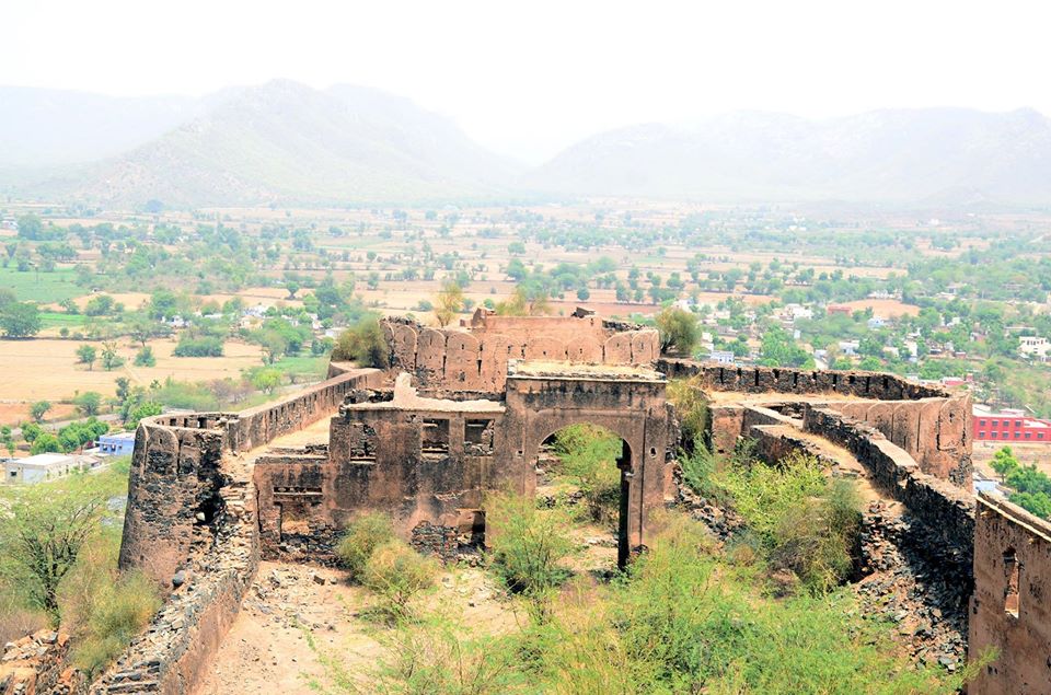
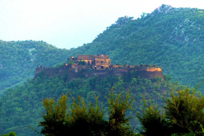
Tehla Fort is situated on top of the hill and looks like crown of the village. It is a magnificent Fort of this area. Actually Tehla was part of Alwar Principality (Riyasat). It was under control the Maharaja of Alwar. However it is not a massive construction but with all royal and defensive segments. There are high ramparts and big enterance. The palatial building on south corner of the fort is really a Rajasthani style. The magnificent plaster done in the corridor is a good construction quality. A beautiful scenic view from the top of the palace is really a great pleasure. The whole geographical area comes under the eyes. The water reservior existed in the complex is the best example of water management and harvesting. The water harvesting concept adopted by the architect of that time is relevant and commendable. This is a scientific attitude of erstwhile management. This Fort can be a boon for the town, if the recent touristic scenario is exploited. Such type of historical asset is a pride for the town. This is the matter of sorrow that a historial building is being neglected by the Govt and locals. Damage to the fort is realy insult of our national property.
"SAVE THE PRIDE OF TEHLA" Nearby cities:Coordinates: 27°14'25"N 76°24'28"E
[youtube https://www.youtube.com/watch?v=41TDiRmlpD8&w=560&h=315]
- To SUBSCRIBE click the below link:
- www.youtube.com/subscription_center?add_user=WildFilmsIndia
- Facebook: www.facebook.com/WildernessFilmsIndiaLimited
- www.wildfilmsindia.com
A milestone creation of the 18th century, Tehla fort is situated in Tehla village near Alwar and is a paradise for history lovers. Being counted in one of the renowned names in mountain forts of Rajasthan, Tehla fort catches the attention of national, international tourists towards its beautiful Rajasthani architecture which preserves the elegance of royal culture in the beauty of its design and strong unshakable walls
8. Sirohi: Jakhiwal
9. Thanagazi (Alwar District) : Mewaal, Rao Shivasingh Meena
Thanagazi Fort
[youtube https://www.youtube.com/watch?v=FFBXjg0obcg&w=560&h=315]
Thanagazi is a major defensive town of Alwar Principality adjacent to Jaipur state. It is located about 40 kms from Alwar very near to Sariska Tiger reserve. This is a average town governed by Gram Panchayat and tehsil HQ. It is an old village, however the exact details of foundation are not available. There is a big fort located top of a small hill adjacent to the populated area. There are high ramparts and bastons. It was under control of erstwhile Maharaja of Alwar since independence. This is a massive fort having historical value. It is a historical tourist interest place in fringe of Sariska tiger Den. It seems that the fort is about four hundred years old. It is the pride for the Thanagazi town. In the near future it may prove boon for the area, if developed as a tourist place. Source : http://wikimapia.org . www.clipahoy.com , India's first video-based social networking experience! Reach us at rupindang @ gmail . com and admin@wildfilmsindia.com
10.Sarjoli mandor
Mandor is an ILRC and village in Phagi Tehsil in Jaipur district, Rajasthan.
Mandor has seven patwar circles - Kansel, Pachala, Mandor, Rotwara, Ladana, Sawai Jaisinghpura and Sultaniya.
Based on 2011 census, Mandor has 158 households with total population of 1,191 (51.89% males, 48.11% females). The total area of the village is 11.55 km2. There is one primary school in the village.
11. Godwar/Gorwar ( Sirohi State) Godmina
Historical capitals :-Nadol,Chandravati, Sirohi
IF anyone justify that Gorwar are BANJARAS ?
Gorwar or Godwar, (in different periods also was called Chandravati Kingdom, Sirohi State) is a region of Rajasthan state in India, which lies in the southwest Rajasthan and borders with the state of Gujarat.
During the early years of the 19th century, Sirohi Kingdom suffered much from wars with Jodhpur and the Meena hill tribes of the area. The protection of the British was sought in 1817; the pretensions of Jodhpur to suzerainty over Sirohi were disallowed, and in 1823 a treaty was concluded with the British government. Sirohi became a self-governing princely state within British India
Now this area is well known for leopard safari, many migratory birds visit Jawai Dam in winters and there many other activities are operated for tourists in this area. Some people also called it as "untouched beauty of rajasthan"Hotels which are popular to stay in Bera include: 1. varawal leopard camp 2. castle Bera 3. Jawai leopard camp 4. Leopard lair resort 5. Baghera camp
PART 1st The End
Ancient Forts Of Rajasthan
Dadhikar Fort Alwar city
Alwar 1100 years ago by King Chand clan of Meena
The Dadhikar Fort, Almost 1100 years ago, around 9-10 century, a residential camp was made in the dense forests amidst the Aravali Hills in Matsya Janpad area by a deserted family of King Chand who had to leave his capital named Abhanagari(the place of grace), now known as Abhaneri after having lost everything in flood there. The word ‘Dera’ denotes camp and thus, place was called as ‘Derakar’ i.e. to make a camp. Gradually with passage of time the name changed and now it is known as Dadhikar, Alwar. This history is supported with the folk song sung by the people of these areas.
“Saher Dadhikar Pargana, Alwar Garh ke pass,
Basti Raja Chand ki, Abhaner Nikas”
Later on, keeping in view the beauty of nature and the safest place all around they permanently settled here, and resided here before moving Nikumbh Mahal (Bala Qila) presently in Alwar and thereafter Dadhikar became the usual place for military camps and manufacturing of battle arms.
The sign of old civilization and its gradual development can apparently be observed here since the Aravali Hills concealing deep caves with ancient rock paintings, Similarly, these are small villages at distant place spreading in the area with least population keeping alive the old culture and traditions.
With the Passage of time, the Fort had gone in to very dilapidated condition which has now been restored its original form renovating with modern necessities to bring the graceful history of the Dadhikar on the world map.
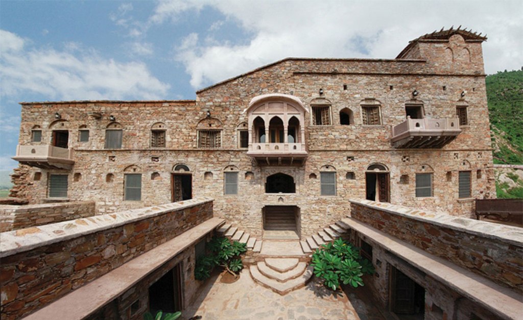
Perched on a little rocky outcrop, backed by wooded hills, Dadhikar Fort has been surveying the surrounding countryside for over 11 centuries. Back in the 9th century, a royal residential camp was set up here in what were then dense forests, when the family of King Chand had to leave their capital - current day Abhaneri - after losing everything in a flood.
Originally known as “derakar” (literally, to make a camp), both the name and the vocation changed over the decades. Derakar became Dadhikar, and the residential camp became military in nature, after the royal family moved to Alwar.
Then, over the centuries, Dadhikar gradually fell into decline and discreet neglect. With no road to connect it to the village below, with no electricity, and no water supplies, life passed Dadhikar by. Until, recently, when a man with a vision, Ram Kaushik, made it his mission to restore this little piece of India’s history.
Mr. Kaushik’s mantra is a simple one – “Preserving our heritage in every way possible, because it is our greatest strength and never ending treasure.”
Preserving Dadhikar & bringing the fort back to life was nothing short of a labour of love.
In 2007, Ram Kaushik bought the fort from the heir of King Chand. “Everybody else saw it as a derelict structure that was devoid of amenities, but I envisioned it as a getaway far from city life, with a breathtaking view.”
“I always had a keen interest in restoration, so I researched what the original fort must have looked like.”
Recycling stones from rubble, hunting down retired masons who could work with the old style of limestone construction, training young labourers from Dadhikar village - these were all part of the restoration work.
Dadhikar Fort is ideally situated as a base to explore the surrounding areas. It is close to Alwar, to Sariska Tiger Reserve, and, just 60 km away is amazing Abhaneri, the largest step well in Asia.
Closer to home are deep caves with ancient rock paintings, which were, excitingly, discovered by the Fort’s owners. These ancient cave paintings lead one to conclude that Dadhikar village is a part of a thousands of years’ old legacy.
Fort of Amaghar
the lost royalty
its mainly founded by MEENA king but later its captured

Amargarh Fort, Rajasthan , India
Location: 25° 26′ 31.01″ N, 75° 10′ 16.06″ E
Amargarh Fort is a 250-year-old fort which stands loftily atop a hill in the Amargarh village in Rajasthan. The fort is named after Raja Amar Mal, who built it. Paddy fields and abundant greenery surrounds the fort. Being surrounded by forests and mountains from all sides, the fort provides a beautiful view to visitors.
Bharmal was the father of Mariam-uz-Zamani (also called Harkha Bai or Hira Kunwari), who was married to the Mughal Emperor Akbar in 1562 and became mother to the emperor Jahangir. This was a significant event in Hindu-Muslim relations at the time. He died in Agra in 1574.
Strange rajput married with mughal to defeat king of amargarh fort ?
Fort of Hathori
Nayan Kingdom
The destruction of the Meena town of "Nayan Kingdom of Meenas" :-
Tod wrote: "When this latter prince (Baharmull Kachwaha, a contemporary of Babur and Humayun) destroyed the Meena sovereignty of Nayan, he levelled its half hundred gates, and erected the town of Lohan ( Lowain) (now the residence of a Rajawat chief) on its ruins" [Tod.II.283].
The name of Meena ruler of Nayan was Raja Bada Meena , he was so rich that his wealth was compared to Akbar's empire in a local saying as
"Rajah Bada ko Bijano, Akabar Ko Gharbaar"
That mean Rajah Bada's manual fan was so precious that it was compared with Akbar's palace.
An old historical proverb records the power of Meena King and Rulers of Nayan, “There were fifty two strongholds, and fifty six gates belonging to the manly Meena, the Raja of Nahn .
The Kachwaha Rajput ruler Bharmal of Amber always eyed on Nayan and attacked on it several times but could not succeeded against mighty and brave Bada Meena.
Akbar had asked Rao Bada meena to marry his daughter Shashivadini , but being a true Meena Kshatriya royal blood, refused the proposal. Later on Bharmal married his daughter Jodhabai to Akbar(Jalāl ud-Dīn Muhammad Akbar). Bharmal was made a noble of high rank in the imperial court, and subsequently his son Bhagwant Das and grandson Man Singh also rose to high ranks in the nobility.
Nandini Sinha Kapur, a historian who has studied early India, notes that the oral traditions of the Meenas were developed from the early 19th century AD in an attempt to reconstruct their identity. She says of this process, which continued throughout the 20th century, that
"The Meenas try to furnish themselves a respectable present by giving themselves a glorious past".
In common with the people of countries such as Finland and Scotland, the Meenas found it necessary to invent tradition through oral accounts, one of the primary uses of which is recognized by both historians and sociologists as being
"social protest against injustices, exploitation and oppression, a raison d'être that helps to retrieve the image of a community."
Kapur notes that the Meenas not merely lack a recorded history of their own but also have been depicted in a negative manner both by Medieval Persian accounts and records of the colonial period. From medieval times through to the British Raj, references to the Meenas describe them as violent, plundering criminals (criminal tribe ACT) and an anti-social ethnic tribal group.
*criminal tribe act:- check posts for detailed info
Meenas in Jat History
War of Jat King Maharaja Kartik with Hill Meenas: James Todd obtained a Pali inscription about Jit or Jat tribe at village Ramchandrapura 3 kos (6 miles) east of Bundi state, which he sent to Asiatic Society London.
The inscription reveals that there was a king Thot born in Uti vansha. His son was Raja Chandrasain, a powerful ruler and beloved king of his subjects. The son of Chandrasain was Kartika, renowned for his prowess. His wife was Gunaniwas, who gave birth to two sons Mukunda and Daruka. Daruka produced son named Kuhal. Kuhal produced son named Dhunak, who achieved great works.
He had war with Hill Meenas tribes and defeated and destroyed them. He along with his brother Dok worshipped gods and brahmanas. They founded a Sun-temple for the pleasure of his beloved wife. The temple will stand till the sumer suvarna mountain stands on the sand. Kuhal had founded this temple and a Maheshwar temple in east. The popularity of this was spread by Achal, son of Mahabali Maharaja Yashovarma.
The period of war of this dynasty with Pahari Meenas is difficult to be assessed. If we assume that Jat ruler Kartik had war with Menander then the period of this comes about 150 BC.
Menander had attacked areas upto Chittor. It is very likely that Kartika had a war with Menander. This way the period of his descendant becomes the first century. If we look into the period of Achal who made this temple popular it comes around third or fourth century or beyond it, as ruler Yashovarman was in Maukhari vansha in eighth century in Kannauj. He had sent a delegation to China in 731 AD. Lack of records and history prior to sixth century prevents prom determining the exact period of the rule of Kartik and his descendants. According to Thakur Deshraj, We can presume their rule from fourth to sixth century.
Fort of Kohoj
Kohoj, the hill fort is situated in Palghar region. One can see this fort while traveling on Mumbai-Ahmadabad highway near Manor Naka.

This fort is at about 12 kms from Wada. We will be taking the route which starts from Waghote. This village is located on Manor-wada route at around 8 kms from Mumbai-Ahmadabad highway. One can reach to the top of Kohoj within 3 hrs from the base village. We can find the name of Kohoj in the list of those 23 forts, which were surrendered by Chatrapati Shivaji Maharaj in the Purandar treaty with Mughal on 11 June 1665.
Fort of Jamwaramgarh

IT IS FAMOUS BECAUSE OF :-
CIVIL SERVANT BELONGINIG TO THIS SUBDIVISION:
IPS Santosh meena
IAS Rohit meena
IRS kharana Jagdish prasad meena
IPS kharkada Mahesh verma
IRS Jamwa rammgarh
IAS Vishram meena
IPS Srinagar Nathu singh meena
IPS Manota Prahlad meena
RAS harsahay meena
Fort of Jalore
Main Lakes and bawaries (to hold water from Rain) build by Meena Kings
- Jait Sagar, Rajasthan
- Panna mina ki bawarie, Amer
- Meen Bhagwan bawarie,near Sariska,Alwar
- Bhuli bawarie,village Sarjoli
- Khogong bawarie, Jaipur
Main temples build by Meena Kings
- Dant Mata Temple (Sehra Meena's dynasty Goddess)
- Shiva Temple at Nayi ka Nath (Banskho), Jaipur
- Banki Mata Temple at Raysar, Jaipur (Byadwal Meena's Dynasty Goddess)
- Meen Bhagwan Mandir,Bassi,Jaipur
- Shiva Temple, Khogonw
- Bai Temple at Badi Chopad Jaipur
'NOTE: Important Book for the reference on above information is
"Meena Cast and History of Freedom" by Shri. Lakshmi Nayaran Jharwal'


